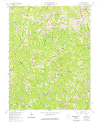
1958 Map of Kettle
USGS Topo · Published 1976About this map
Deep in the Appalachian Plateau, this mid-century survey captures the rural economy of Roane and Kanawha counties defined by its petroleum and agricultural output. The terrain is a dense network of ridges and hollows, where energy production is evidenced by the Rock Creek Oil Field, the Green Creek Oil Field, and the McKown Oil Field. Small settlements like Kettle and Doddtown anchor the landscape, while numerous country schools such as the Ambler Sch and Sandy Knob Sch indicate a widely distributed mountain population prior to mid-century consolidation.
Find a feature on this map
93 named features on this map. Tap any name to fly to it.
Don’t see what you’re looking for? This feature index may not catch every label — zoom into the map to look around manually.
Map Details
Editions of this 1958 Kettle Map
3 editions found
Other maps of this area

1897 · Kanawha Falls
USGS Topo · 1:125,000

1899 · Charleston
USGS Topo · 1:125,000

1900 · Kanawha Falls
USGS Topo · 1:125,000

1901 · Kanawha Falls
USGS Topo · 1:125,000

1906 · Kenna
USGS Topo · 1:62,500

1906 · Walton
USGS Topo · 1:62,500

1907 · Kenna
USGS Topo · 1:62,500

1907 · Walton
USGS Topo · 1:62,500

1907 · Clendenin
USGS Topo · 1:62,500

1909 · Charleston
USGS Topo · 1:62,500