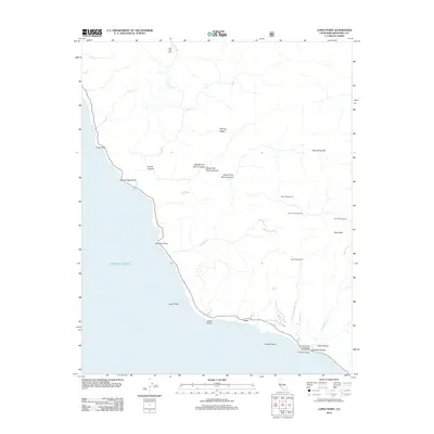
2012 Map of Lopez Point
USGS Topo · Published 2012About this map
The coastal settlement of Lucia sits along the steep Pacific cliffs, marking a focal point of this 2012 survey. The landscape is defined by its dramatic transition from the Pacific Ocean to high elevations like Mining Ridge and Twin Peak. The shoreline is dotted with significant offshore landmarks, including Lopez Rock, Harlan Rock, and Dolan Rock, while the rugged coast is cut by steep drainages such as Devils Canyon and Hare Canyon.
Find a feature on this map
32 named features on this map. Tap any name to fly to it.
Don’t see what you’re looking for? This feature index may not catch every label — zoom into the map to look around manually.
Map Details
Editions of this 2012 Lopez Point Map
This is the sole edition of this map. No revisions or reprints were ever made.
Other maps of this area

1919 · Junipero Serra
USGS Topo · 1:62,500

1921 · Cape San Martin
USGS Topo · 1:62,500

1921 · Lucia
USGS Topo · 1:62,500

1941 · Cape San Martin
USGS Topo · 1:62,500

1941 · Lucia
USGS Topo · 1:62,500

1941 · Junipero Serra
USGS Topo · 1:62,500

1942 · Cape San Martin
USGS Topo · 1:62,500

1947 · Lucia
USGS Topo · 1:62,500

1947 · San Luis Obispo
USGS Topo · 1:250,000

1948 · Santa Cruz
USGS Topo · 1:250,000