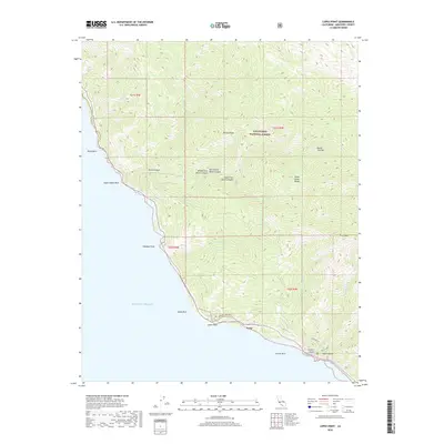
2018 Map of Lopez Point
USGS Topo · Published 2018About this map
Lucia sits along the steep California coast, serving as a primary point of human settlement where the mountains meet the sea. This 2018 survey reveals a landscape largely shaped by the dramatic elevations of the Santa Lucia Range, much of which is protected within the Los Padres National Forest. The map details the complex drainage systems that carve the terrain, including Limekiln Canyon and Devils Canyon, which separate prominent heights like Mining Ridge and Round Tree Hill. Coastal landmarks such as Lopez Point, Gamboa Point, and the off-shore Dolan Rock define the jagged interface with the Pacific Ocean. Backcountry access is illustrated through established routes like the Limekiln Trl and Hare Creek Trl, which connect the shoreline to the high interior peaks like Twin Peak. The presence of the Morning Glory Ranch suggests the continued, if sparse, private utilization of this challenging topography.
Find a feature on this map
33 named features on this map. Tap any name to fly to it.
Don’t see what you’re looking for? This feature index may not catch every label — zoom into the map to look around manually.
Map Details
Editions of this 2018 Lopez Point Map
This is the sole edition of this map. No revisions or reprints were ever made.
Other maps of this area

1919 · Junipero Serra
USGS Topo · 1:62,500

1921 · Cape San Martin
USGS Topo · 1:62,500

1921 · Lucia
USGS Topo · 1:62,500

1941 · Cape San Martin
USGS Topo · 1:62,500

1941 · Lucia
USGS Topo · 1:62,500

1941 · Junipero Serra
USGS Topo · 1:62,500

1942 · Cape San Martin
USGS Topo · 1:62,500

1947 · Lucia
USGS Topo · 1:62,500

1947 · San Luis Obispo
USGS Topo · 1:250,000

1948 · Santa Cruz
USGS Topo · 1:250,000