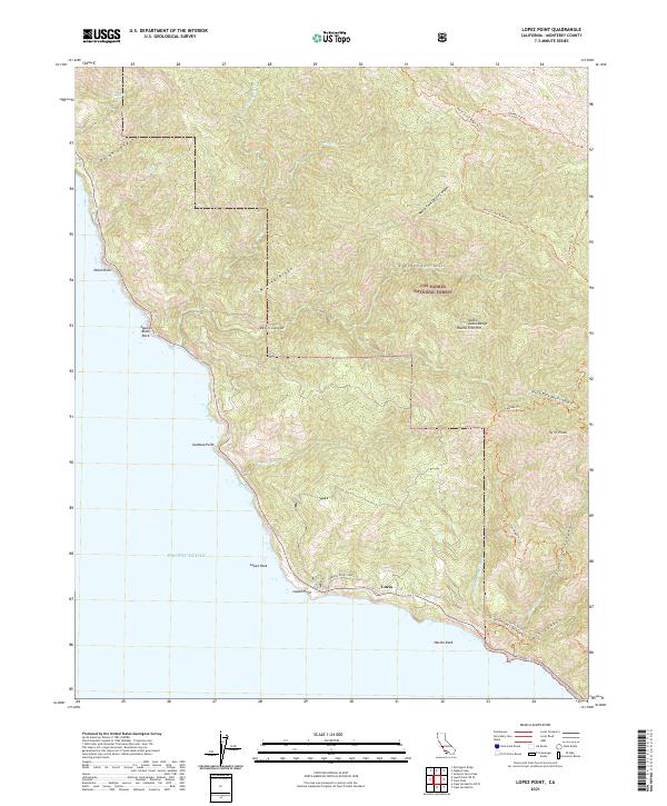
2021 Map of Lopez Point
USGS Topo · Published 2021About this map
The settlement of Lucia sits along the steep Pacific coastline within the Los Padres National Forest, where the mountains of the Santa Lucia Range drop sharply into the sea. This recent survey captures a landscape defined by dramatic elevation changes, from coastal landmarks like Lopez Point and Harlan Rock to the high reaches of Mining Ridge and Round Tree Hill. The drainage patterns are intricate, with Devils Canyon and Limekiln Canyon carving deep paths through the terrain toward the Pacific Ocean.
Find a feature on this map
40 named features on this map. Tap any name to fly to it.
Don’t see what you’re looking for? This feature index may not catch every label — zoom into the map to look around manually.
Map Details
Editions of this 2021 Lopez Point Map
This is the sole edition of this map. No revisions or reprints were ever made.
Other maps of this area

1919 · Junipero Serra
USGS Topo · 1:62,500

1921 · Cape San Martin
USGS Topo · 1:62,500

1921 · Lucia
USGS Topo · 1:62,500

1941 · Cape San Martin
USGS Topo · 1:62,500

1941 · Lucia
USGS Topo · 1:62,500

1941 · Junipero Serra
USGS Topo · 1:62,500

1942 · Cape San Martin
USGS Topo · 1:62,500

1947 · Lucia
USGS Topo · 1:62,500

1947 · San Luis Obispo
USGS Topo · 1:250,000

1948 · Santa Cruz
USGS Topo · 1:250,000