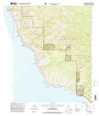
1995 Map of Lopez Point
USGS Topo · Published 2000About this map
Coast Road winds through the steep coastal topography of Monterey County, tracing a landscape defined by the intersection of the Santa Lucia Range and the Pacific. This mid-1990s revision reveals a region heavily designated for conservation, where the Ventana Wilderness and Big Creek State Reserve protect the drainages of the North Fork, Middle Fork, and South Fork Big Creek. The small settlement of Lucia and the historic site at Rockland Landing serve as the primary human touchpoints in an otherwise formidable terrain of deep canyons like Devils Canyon and Hare Canyon. Maritime and geodetic features such as Lopez Point and Gamboa Point anchor the shoreline, while inland trails like the Gamboa Trail provide access to backcountry landmarks including Twin Peak and the Trail Spring Campsite.
Find a feature on this map
33 named features on this map. Tap any name to fly to it.
Don’t see what you’re looking for? This feature index may not catch every label — zoom into the map to look around manually.
Map Details
Editions of this 1995 Lopez Point Map
This is the sole edition of this map. No revisions or reprints were ever made.
Other maps of this area

1919 · Junipero Serra
USGS Topo · 1:62,500

1921 · Cape San Martin
USGS Topo · 1:62,500

1921 · Lucia
USGS Topo · 1:62,500

1941 · Cape San Martin
USGS Topo · 1:62,500

1941 · Lucia
USGS Topo · 1:62,500

1941 · Junipero Serra
USGS Topo · 1:62,500

1942 · Cape San Martin
USGS Topo · 1:62,500

1947 · Lucia
USGS Topo · 1:62,500

1947 · San Luis Obispo
USGS Topo · 1:250,000

1948 · Santa Cruz
USGS Topo · 1:250,000