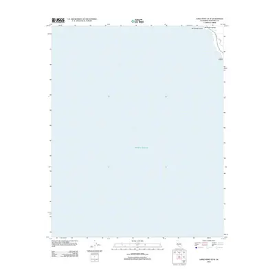
2012 Map of Lopez Point OE W
USGS Topo · Published 2012About this map
Slates Hot Springs sits at the edge of the Monterey County coast, where the steep terrain of the Santa Lucia Range meets the Pacific Ocean. This coastal survey highlights the precarious geography of the Big Sur region, defined by deep drainage basins like Hot Springs Canyon and Dolan Canyon. The settlement here is deeply tied to the natural thermal activity of the land, with Dolan Rd providing the primary land-based access along the rugged shoreline. This 2012 view illustrates the intersection of narrow canyons and the vast maritime horizon, recording the footprint of a isolated coastal community before the landscape was further altered by more recent natural events common to this volatile stretch of California coastline.
Find a feature on this map
5 named features on this map. Tap any name to fly to it.
Don’t see what you’re looking for? This feature index may not catch every label — zoom into the map to look around manually.
Map Details
Editions of this 2012 Lopez Point OE W Map
This is the sole edition of this map. No revisions or reprints were ever made.
Other maps of this area

1921 · Lucia
USGS Topo · 1:62,500

1941 · Lucia
USGS Topo · 1:62,500

1947 · Lucia
USGS Topo · 1:62,500

1947 · San Luis Obispo
USGS Topo · 1:250,000

1948 · Santa Cruz
USGS Topo · 1:250,000

1948 · San Luis Obispo
USGS Topo · 1:250,000

1955 · Santa Cruz
USGS Topo · 1:250,000
1956 · Lopez Point
USGS Topo · 1:24,000
1956 · Partington Ridge
USGS Topo · 1:24,000
1956 · Pfeiffer Point
USGS Topo · 1:24,000