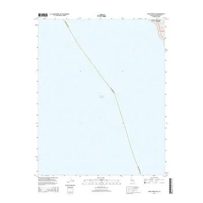
2015 Map of Lopez Point OE W
USGS Topo · Published 2015About this map
Slates Hot Springs clings to the steep coastline of Monterey County, representing a rare point of named human settlement along this dramatic stretch of the Pacific Ocean. The landscape is defined by its verticality, where the coastal mountains drop precipitously toward the sea, carved by drainage features like Hot Springs Canyon and the small course of Lime Cr. This 2015 record captures the area within Township 21 South, Range 3 East, at a time when the topography remained largely undeveloped, dominated by natural hydrothermal features and the wild California shoreline. The map illustrates the extreme transition from the high-altitude ridges of the Santa Lucia Range down to the tidal margins, a geography that historically dictated the placement of isolated outposts and early coastal trails.
Find a feature on this map
7 named features on this map. Tap any name to fly to it.
Don’t see what you’re looking for? This feature index may not catch every label — zoom into the map to look around manually.
Map Details
Editions of this 2015 Lopez Point OE W Map
This is the sole edition of this map. No revisions or reprints were ever made.
Other maps of this area

1921 · Lucia
USGS Topo · 1:62,500

1941 · Lucia
USGS Topo · 1:62,500

1947 · Lucia
USGS Topo · 1:62,500

1947 · San Luis Obispo
USGS Topo · 1:250,000

1948 · Santa Cruz
USGS Topo · 1:250,000

1948 · San Luis Obispo
USGS Topo · 1:250,000

1955 · Santa Cruz
USGS Topo · 1:250,000
1956 · Lopez Point
USGS Topo · 1:24,000
1956 · Partington Ridge
USGS Topo · 1:24,000
1956 · Pfeiffer Point
USGS Topo · 1:24,000