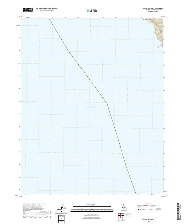
2021 Map of Lopez Point OE W
USGS Topo · Published 2021About this map
Slates Hot Springs sits perched on the northern edge of this coastal landscape, where the land meets the vast expanse of the Pacific Ocean. This 2021 study focus is primarily on the offshore and nearshore environment along the Monterey County coast, documenting the transition from steep coastal slopes to open water. Inland features are concentrated in the northeast corner, dominated by the drainage of Hot Springs Canyon and the flow of Lime Cr. The presence of Dolan Ridge and the nearby Dolan Canyon suggests a complex drainage system typical of the region's coastal frontage. This specific sheet provides a detailed look at the interface between private land and federal surveying boundaries within t21s r3e, marking a point of interest for those studying historical land use and early 21st-century topography along this remote stretch of coastline.
Find a feature on this map
7 named features on this map. Tap any name to fly to it.
Don’t see what you’re looking for? This feature index may not catch every label — zoom into the map to look around manually.
Map Details
Editions of this 2021 Lopez Point OE W Map
This is the sole edition of this map. No revisions or reprints were ever made.
Other maps of this area

1921 · Lucia
USGS Topo · 1:62,500

1941 · Lucia
USGS Topo · 1:62,500

1947 · Lucia
USGS Topo · 1:62,500

1947 · San Luis Obispo
USGS Topo · 1:250,000

1948 · Santa Cruz
USGS Topo · 1:250,000

1948 · San Luis Obispo
USGS Topo · 1:250,000

1955 · Santa Cruz
USGS Topo · 1:250,000
1956 · Lopez Point
USGS Topo · 1:24,000
1956 · Partington Ridge
USGS Topo · 1:24,000
1956 · Pfeiffer Point
USGS Topo · 1:24,000