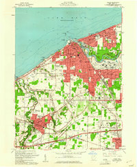
1960 Map of Lorain
USGS Topo · Published 1961About this map
Industrial activity and lakefront commerce define the city of Lorain during the early 1960s, where the Black River meets Lake Erie. This period shows the heavy infrastructure of the era, including the drydocks and the turning basin that serviced the Great Lakes shipping trade. The landscape is densely packed with parochial institutions such as St Marys Sch, Holy Trinity Sch, and SS Peter and Paul Ch, reflecting the heritage of the local workforce.
Find a feature on this map
94 named features on this map. Tap any name to fly to it.
Don’t see what you’re looking for? This feature index may not catch every label — zoom into the map to look around manually.
Map Details
Editions of this 1960 Lorain Map
This is the sole edition of this map. No revisions or reprints were ever made.
Other maps of this area

1901 · Oberlin
USGS Topo · 1:62,500

1903 · Vermilion
USGS Topo · 1:62,500

1903 · Oberlin
USGS Topo · 1:62,500

1953 · Grafton
USGS Topo · 1:24,000

1953 · Avon
USGS Topo · 1:24,000

1956 · Toledo
USGS Topo · 1:250,000

1959 · Vermilion East
USGS Topo · 1:24,000

1959 · Kipton
USGS Topo · 1:24,000

1960 · Oberlin
USGS Topo · 1:24,000

1961 · Toledo
USGS Topo · 1:250,000