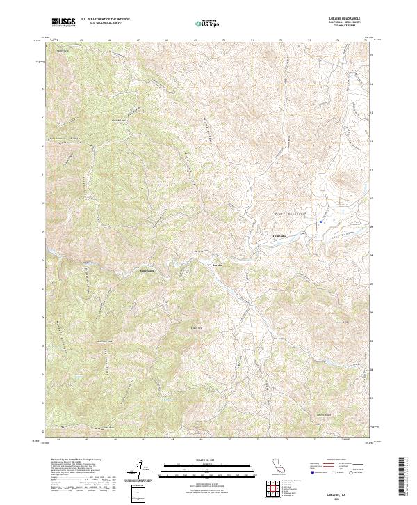
2021 Map of Loraine
USGS Topo · Published 2021About this map
Loraine and the smaller cluster at Millersville represent the primary points of settlement within this mountain landscape, positioned along the winding course of Caliente Creek. The geography is defined by deep incisions and sharp elevations, where names like Antimony Peak and Black Bill Peak signal a history of mining and localized prospecting in the southern Sierra Nevada. The transport network follows the natural contours of the land, with Caliente Creek Rd serving as the main artery connecting the canyon floor to the surrounding heights.
Find a feature on this map
69 named features on this map. Tap any name to fly to it.
Don’t see what you’re looking for? This feature index may not catch every label — zoom into the map to look around manually.
Map Details
Editions of this 2021 Loraine Map
This is the sole edition of this map. No revisions or reprints were ever made.
Other maps of this area

1914 · Caliente
USGS Topo · 1:125,000

1915 · Mojave
USGS Topo · 1:125,000

1943 · Tehachapi
USGS Topo · 1:62,500

1943 · Emerald Mtn
USGS Topo · 1:62,500

1943 · Cummings Mountain
USGS Topo · 1:62,500

1943 · Breckenridge Mountain
USGS Topo · 1:62,500

1948 · Bakersfield
USGS Topo · 1:250,000

1955 · Bakersfield
USGS Topo · 1:250,000

1956 · Bakersfield
USGS Topo · 1:250,000

1960 · Bakersfield
USGS Topo · 1:250,000