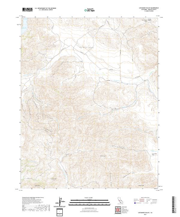
2021 Map of Los Banos Valley
USGS Topo · Published 2021About this map
The Diablo Range defines the steep, ridged landscape of this portion of Merced County, where the Los Banos Valley provides a rare pocket of flatter terrain. To the northwest, the San Luis Reservoir reaches into the hills at Lone Oak Bay, a major water feature that contrasts with the seasonal drainages of N Fork Los Banos Cr and Wildcat Cr. The map reveals a remote ranching or backcountry landscape accessed via winding corridors like Billy Wright Rd and Sweeny Rd.
Find a feature on this map
33 named features on this map. Tap any name to fly to it.
Don’t see what you’re looking for? This feature index may not catch every label — zoom into the map to look around manually.
Map Details
Editions of this 2021 Los Banos Valley Map
This is the sole edition of this map. No revisions or reprints were ever made.
Other maps of this area

1913 · Panoche
USGS Topo · 1:125,000

1920 · Pacheco Pass
USGS Topo · 1:62,500

1920 · Carrisalito Spring
USGS Topo · 1:31,680

1921 · Volta
USGS Topo · 1:31,680

1922 · Quien Sabe
USGS Topo · 1:62,500

1922 · San Luis Creek
USGS Topo · 1:31,680

1922 · Ortigalita
USGS Topo · 1:31,680

1940 · Pacheco Pass
USGS Topo · 1:62,500

1940 · Quien Sabe
USGS Topo · 1:62,500

1943 · Ortigalita Peak
USGS Topo · 1:62,500