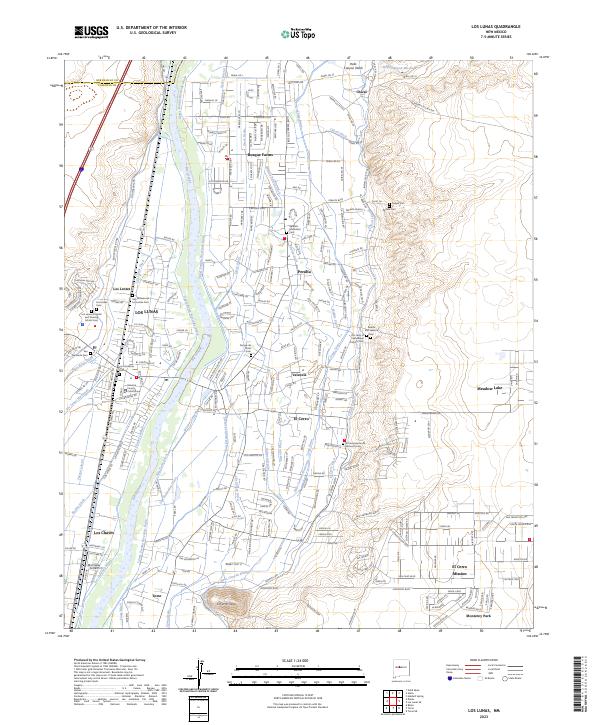
2023 Map of Los Lunas
USGS Topo · Published 2023About this map
The Rio Grande corridor south of Albuquerque defines this landscape, where ancient river management systems sustain a string of agricultural settlements. The complex network of water features, including the Upper Peralta Riverside Drain, Los Lunas Ditch, and Tome Drain, illustrates the critical importance of irrigation in the Rio Grande Valley. These channels weave through communities like Los Lentes, Bosque Farms, and Peralta, supporting a transition from traditional farming to modern residential expansion.
Find a feature on this map
94 named features on this map. Tap any name to fly to it.
Don’t see what you’re looking for? This feature index may not catch every label — zoom into the map to look around manually.
Map Details
Editions of this 2023 Los Lunas Map
This is the sole edition of this map. No revisions or reprints were ever made.
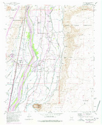
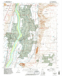
Historical Maps of Valencia Through Time
3 maps found