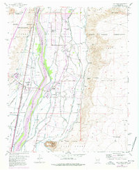
1952 Map of Los Lunas
USGS Topo · Published 1978About this map
The Rio Grande corridor south of Albuquerque is defined here by an intricate web of irrigation and drainage infrastructure designed to manage the river's fertile but unpredictable floodplain. By the mid-20th century, the landscape was a patchwork of Spanish land grants, including the Tome Grant and Lo de Padilla Grant, where traditional acequia systems like the Chical Ditch and Peralta Main Canal sustained agriculture alongside the Atchison Topeka and Santa Fe railroad.
Find a feature on this map
80 named features on this map. Tap any name to fly to it.
Don’t see what you’re looking for? This feature index may not catch every label — zoom into the map to look around manually.
Map Details
Editions of this 1952 Los Lunas Map
Other maps of this area

1952 · Wind Mesa
USGS Topo · 1:24,000

1952 · Dalies
USGS Topo · 1:24,000

1952 · Tome NE
USGS Topo · 1:24,000

1952 · Belen
USGS Topo · 1:24,000

1952 · Hubbell Spring
USGS Topo · 1:24,000

1952 · Tome
USGS Topo · 1:24,000

1952 · Los Lunas SE
USGS Topo · 1:24,000

1952 · Los Lunas
USGS Topo · 1:24,000

1952 · Isleta
USGS Topo · 1:24,000

1954 · Socorro
USGS Topo · 1:250,000