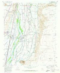
1952 Map of Los Lunas
USGS Topo · Published 1973About this map
The Rio Grande valley south of Albuquerque is defined here by a dense network of irrigation and drainage infrastructure supporting agricultural life in the early 1950s. Water management is central to the landscape, from the Belen High Line Canal and Peralta Main Canal to smaller local systems like the Fernandez Ditch and Las Gercas Ditch. These waterways sustain the historic settlements of Los Lunas, Peralta, and Valencia, which are anchored by community landmarks such as St Anthony Church and the Valencia School.
Find a feature on this map
67 named features on this map. Tap any name to fly to it.
Don’t see what you’re looking for? This feature index may not catch every label — zoom into the map to look around manually.
Map Details
Editions of this 1952 Los Lunas Map
Other maps of this area

1952 · Wind Mesa
USGS Topo · 1:24,000

1952 · Dalies
USGS Topo · 1:24,000

1952 · Tome NE
USGS Topo · 1:24,000

1952 · Belen
USGS Topo · 1:24,000

1952 · Hubbell Spring
USGS Topo · 1:24,000

1952 · Tome
USGS Topo · 1:24,000

1952 · Los Lunas SE
USGS Topo · 1:24,000

1952 · Los Lunas
USGS Topo · 1:24,000

1952 · Isleta
USGS Topo · 1:24,000

1954 · Socorro
USGS Topo · 1:250,000