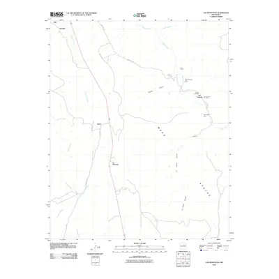
2010 Map of Los Montoyas
USGS Topo · Published 2010About this map
The Gallinas River and Tecolote Creek drainage systems define this San Miguel County landscape, where small settlements and ranching operations are connected by a web of local roads. In the eastern portion of the quadrangle, San Augustin serves as a focal point for local history with the presence of the Lourdes Post Office and the San Augustin Cemetery. The geography is heavily influenced by significant landforms such as Mesa Apache, which is bordered by Apache Canyon and La Cueva Canyon. Water management is evident through the presence of the San Augustin Dam and Concepcion Dam along the river's course. Smaller populated places like Los Montoyas, Sheridan, and Los Fuertes are scattered throughout, often situated near watercourses like Arroyo la Manga, reflecting a traditional settlement pattern based on accessible water in a semi-arid environment.
Find a feature on this map
22 named features on this map. Tap any name to fly to it.
Don’t see what you’re looking for? This feature index may not catch every label — zoom into the map to look around manually.
Map Details
Editions of this 2010 Los Montoyas Map
This is the sole edition of this map. No revisions or reprints were ever made.
Other maps of this area

1889 · Las Vegas
USGS Topo · 1:125,000

1890 · Bernal
USGS Topo · 1:125,000

1891 · Bernal
USGS Topo · 1:125,000

1891 · Las Vegas
USGS Topo · 1:125,000

1893 · Las Vegas
USGS Topo · 1:125,000

1894 · Bernal
USGS Topo · 1:125,000

1954 · Santa Fe
USGS Topo · 1:250,000

1958 · Santa Fe
USGS Topo · 1:250,000

1960 · Villanueva
USGS Topo · 1:62,500

1960 · Apache Springs
USGS Topo · 1:62,500