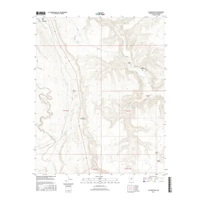
2017 Map of Los Montoyas
USGS Topo · Published 2017About this map
Los Montoyas and San Augustin represent small, traditional communities in the highlands of San Miguel County. The landscape is defined by the carved paths of the Gallinas River and Tecolote Creek, which provide narrow corridors of water in an otherwise arid high-desert environment. Local genealogy and settlement patterns are anchored by features like the San Augustin Cem, while family-named land features such as Charles Ranch and Gabe Rd hint at the rural ranching heritage of the area. The topography is marked by deep incisions like Apache Canyon and La Cueva Canyon, as well as the broad elevation of Apache Mesa. The network of local roads, including Co Rd C24 and Sheridan Rd, connects isolated points like Sheridan and Myers to the surrounding New Mexican territory.
Find a feature on this map
28 named features on this map. Tap any name to fly to it.
Don’t see what you’re looking for? This feature index may not catch every label — zoom into the map to look around manually.
Map Details
Editions of this 2017 Los Montoyas Map
This is the sole edition of this map. No revisions or reprints were ever made.
Other maps of this area

1889 · Las Vegas
USGS Topo · 1:125,000

1890 · Bernal
USGS Topo · 1:125,000

1891 · Bernal
USGS Topo · 1:125,000

1891 · Las Vegas
USGS Topo · 1:125,000

1893 · Las Vegas
USGS Topo · 1:125,000

1894 · Bernal
USGS Topo · 1:125,000

1954 · Santa Fe
USGS Topo · 1:250,000

1958 · Santa Fe
USGS Topo · 1:250,000

1960 · Villanueva
USGS Topo · 1:62,500

1960 · Apache Springs
USGS Topo · 1:62,500