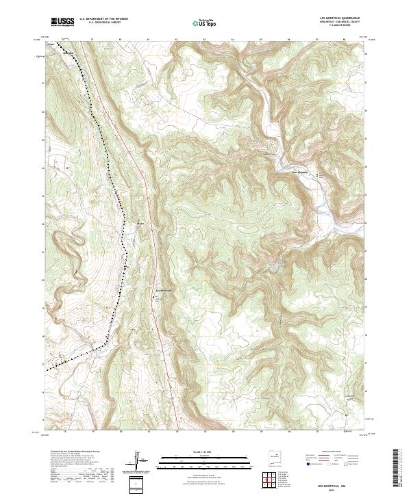
2023 Map of Los Montoyas
USGS Topo · Published 2023About this map
Los Montoyas and San Augustin anchor this portion of San Miguel County, situated where the high plains meet the intricate canyon systems of the Sangre de Cristo foothills. The landscape is defined by the drainage patterns of the Gallinas River and Tecolote Creek, which carve deep paths through the terrain near Mesa Apache. For local historians and genealogists, the inclusion of the Los Montoyas Cem and San Augustin Cem provides critical points for family research in these long-established communities. The northern reaches of the map include a portion of the Las Vegas National Wildlife Refuge near Arroyo Vegoso, illustrating the protected natural spaces that border private ranch lands and small settlements. The transition from the high mesa at Ca%C3%B1on de Aguilar to the valley floors reveals a traditional New Mexican land-use pattern where water sources like La Cueva Spring dictated the location of homesteads and grazing routes.
Find a feature on this map
28 named features on this map. Tap any name to fly to it.
Don’t see what you’re looking for? This feature index may not catch every label — zoom into the map to look around manually.
Map Details
Editions of this 2023 Los Montoyas Map
This is the sole edition of this map. No revisions or reprints were ever made.
Other maps of this area

1889 · Las Vegas
USGS Topo · 1:125,000

1890 · Bernal
USGS Topo · 1:125,000

1891 · Bernal
USGS Topo · 1:125,000

1891 · Las Vegas
USGS Topo · 1:125,000

1893 · Las Vegas
USGS Topo · 1:125,000

1894 · Bernal
USGS Topo · 1:125,000

1954 · Santa Fe
USGS Topo · 1:250,000

1958 · Santa Fe
USGS Topo · 1:250,000

1960 · Villanueva
USGS Topo · 1:62,500

1960 · Apache Springs
USGS Topo · 1:62,500