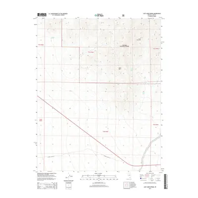
2014 Map of Lost Cabin Spring
USGS Topo · Published 2014About this map
Toiyabe National Forest encompasses a large portion of this Clark County landscape, where the high elevations of the Spring Mountains descend into the arid Mojave Desert. The survival of early inhabitants and travelers in this environment was tied directly to reliable water sources, many of which are identified here. High-country waters like Appaloosa Springs and Younts Spring provided critical stops for those moving through the mountain ranges. Further east, the namesake Lost Cabin Spring and nearby Lower Ranch Spring mark points of historical interest in the transition from peaks to valley floor. Modern access across the southern portion of the sheet is defined by Cathedral Canyon Rd, while the township and range boundaries provide a clear grid for tracking land ownership and historical mining or ranching claims.
Find a feature on this map
14 named features on this map. Tap any name to fly to it.
Don’t see what you’re looking for? This feature index may not catch every label — zoom into the map to look around manually.
Map Details
Editions of this 2014 Lost Cabin Spring Map
This is the sole edition of this map. No revisions or reprints were ever made.
Other maps of this area

1907 · Las Vegas
USGS Topo · 1:250,000

1908 · Las Vegas
USGS Topo · 1:250,000

1910 · Ivanpah
USGS Topo · 1:250,000

1912 · Ivanpah
USGS Topo · 1:250,000

1942 · Ivanpah
USGS Topo · 1:250,000

1947 · Kingman
USGS Topo · 1:250,000

1948 · Kingman
USGS Topo · 1:250,000

1954 · Las Vegas
USGS Topo · 1:250,000

1954 · Kingman
USGS Topo · 1:250,000

1955 · Kingman
USGS Topo · 1:250,000