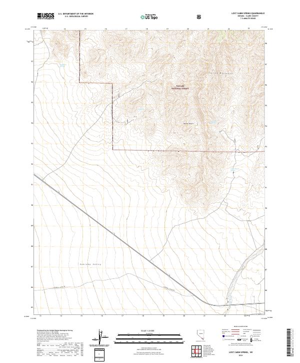
2021 Map of Lost Cabin Spring
USGS Topo · Published 2021About this map
The Spring Mountains dominate this arid landscape where the eastern edge of the Mojave Desert meets the high elevations of the Toiyabe National Forest. This 2021 survey details a rugged terrain defined by seasonal water sources and expansive alluvial fans. Essential water points such as Appaloosa Springs, Younts Spring, and Lost Cabin Spring are mapped along the mountain slopes, indicating the critical nature of these features for both wildlife and human travel in the high desert.
Find a feature on this map
16 named features on this map. Tap any name to fly to it.
Don’t see what you’re looking for? This feature index may not catch every label — zoom into the map to look around manually.
Map Details
Editions of this 2021 Lost Cabin Spring Map
This is the sole edition of this map. No revisions or reprints were ever made.
Other maps of this area

1907 · Las Vegas
USGS Topo · 1:250,000

1908 · Las Vegas
USGS Topo · 1:250,000

1910 · Ivanpah
USGS Topo · 1:250,000

1912 · Ivanpah
USGS Topo · 1:250,000

1942 · Ivanpah
USGS Topo · 1:250,000

1947 · Kingman
USGS Topo · 1:250,000

1948 · Kingman
USGS Topo · 1:250,000

1954 · Las Vegas
USGS Topo · 1:250,000

1954 · Kingman
USGS Topo · 1:250,000

1955 · Kingman
USGS Topo · 1:250,000