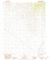
1984 Map of Lost Cabin Spring
USGS Topo · Published 1984About this map
Spring Mountains terrain dominates this 1984 provisional survey of Clark County, where the scarcity of water is marked by a handful of remote points like Lost Cabin Spring, Younts Spring, and Appaloosa Springs. These water sources provided the necessary lifeline for early ranching and mining efforts in this arid landscape. Evidence of small-scale mineral exploration is scattered across the topography, indicated by multiple labeled Prospects and a prospect site. The infrastructure of the early 1980s is represented by the Double Wooden Pole Transmission Line cutting across the sections, while the drainage of Lovell Wash and a nearby Gaging Station highlight the importance of monitoring the limited hydrological flow in the high desert. A lone Corral suggests the continued, if sparse, agricultural use of these foothills.
Find a feature on this map
16 named features on this map. Tap any name to fly to it.
Don’t see what you’re looking for? This feature index may not catch every label — zoom into the map to look around manually.
Map Details
Editions of this 1984 Lost Cabin Spring Map
This is the sole edition of this map. No revisions or reprints were ever made.
Other maps of this area

1907 · Las Vegas
USGS Topo · 1:250,000

1908 · Las Vegas
USGS Topo · 1:250,000

1910 · Ivanpah
USGS Topo · 1:250,000

1912 · Ivanpah
USGS Topo · 1:250,000

1942 · Ivanpah
USGS Topo · 1:250,000

1947 · Kingman
USGS Topo · 1:250,000

1948 · Kingman
USGS Topo · 1:250,000

1954 · Las Vegas
USGS Topo · 1:250,000

1954 · Kingman
USGS Topo · 1:250,000

1955 · Kingman
USGS Topo · 1:250,000