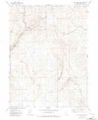
1980 Map of Lost Creek Pass
USGS Topo · Published 1980About this map
Lost Creek Pass serves as a critical geographic navigation point in this high-desert region of Washoe County during the early 1980s. The landscape is defined by its water sources, essential for ranching and survival in the arid Great Basin, with features like Lost Creek Troughs, Cherry Springs, and the seasonal flow of No Savvy Creek providing vital infrastructure. The terrain is marked by significant landmarks such as Devils Gate and the broad expanse of Duck Flat to the south. This survey reveals a network of primitive transportation, primarily a Jeep Trail, winding through Summit Spring Canyon and Sheep Spring Canyon. The presence of named troughs and multiple localized Springs suggests a landscape managed for livestock, where every water point is significant enough to be formally mapped and named.
Find a feature on this map
16 named features on this map. Tap any name to fly to it.
Don’t see what you’re looking for? This feature index may not catch every label — zoom into the map to look around manually.
Map Details
Editions of this 1980 Lost Creek Pass Map
This is the sole edition of this map. No revisions or reprints were ever made.
Other maps of this area

1886 · Granite Range
USGS Topo · 1:250,000

1889 · Long Valley
USGS Topo · 1:250,000

1894 · Granite Range
USGS Topo · 1:250,000

1954 · Vya
USGS Topo · 1:250,000

1955 · Lovelock
USGS Topo · 1:250,000

1958 · Vya
USGS Topo · 1:250,000

1959 · Lovelock
USGS Topo · 1:250,000

1962 · Vya
USGS Topo · 1:250,000
1979 · Wall Canyon Reservoir
USGS Topo · 1:24,000
1979 · Chester Lyons Spring
USGS Topo · 1:24,000