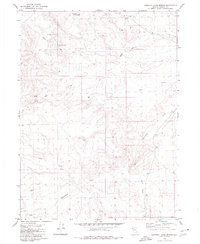
1979 Map of Chester Lyons Spring
USGS Topo · Published 1980About this map
Chester Lyons Spring and other scattered water sources define the survival patterns in this arid corner of Washoe County during the late 1970s. The landscape is marked by the vital necessity of water in high-desert ranching and transit, evidenced by named sites such as Findman Spring, Gillam Spring, and a strategically placed Water Tank. Human habitation is sparse, centered on the Cavin Place, while movement across the terrain is facilitated by a network of primitive tracks and Jeep Trails. Drainage patterns are carved by seasonal flows like Cottonwood Creek and Jims Creek, which feed into the broader basin of Grass Valley. This survey captures the isolated character of the Nevada backcountry before modern infrastructure altered the traditional reliance on these specific, named springs and wells.
Find a feature on this map
14 named features on this map. Tap any name to fly to it.
Don’t see what you’re looking for? This feature index may not catch every label — zoom into the map to look around manually.
Map Details
Editions of this 1979 Chester Lyons Spring Map
This is the sole edition of this map. No revisions or reprints were ever made.
Other maps of this area

1889 · Long Valley
USGS Topo · 1:250,000

1954 · Vya
USGS Topo · 1:250,000

1958 · Vya
USGS Topo · 1:250,000

1962 · Vya
USGS Topo · 1:250,000

1972 · Mahogany Mtn
USGS Topo · 1:24,000

1978 · Hart Mountain
USGS Topo · 1:24,000

1979 · Butte Spring
USGS Topo · 1:24,000
1979 · Pinto Springs
USGS Topo · 1:24,000
1980 · Fox Mountain
USGS Topo · 1:24,000
1980 · Leadville
USGS Topo · 1:24,000