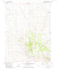
1980 Map of Fox Mountain
USGS Topo · Published 1980About this map
Granite Range peaks dominate this high-desert terrain of northwestern Nevada, where water sources define the limited human footprint. In the 1970s and early 1980s, the area supported a specialized landscape of ranching and communication, anchored by the Grass Valley Ranch and its nearby Grass Valley Reservoir. The map reveals a network of vital water points with evocative local names such as Potato Patch Spring, 75 Dollar Spring, and Mahogany Troughs Spring. Small-scale infrastructure like the Landing Field and a high-elevation Radio Facility on Lookout Mountain suggest the remote coordination required for land management in Washoe County. This survey traces the rugged drainage patterns of Cottonwood Creek and No Savvy Creek, providing a detailed record of the springs and jeep trails that once served as the primary transit routes through these interior basins.
Find a feature on this map
29 named features on this map. Tap any name to fly to it.
Don’t see what you’re looking for? This feature index may not catch every label — zoom into the map to look around manually.
Map Details
Editions of this 1980 Fox Mountain Map
This is the sole edition of this map. No revisions or reprints were ever made.
Other maps of this area

1886 · Granite Range
USGS Topo · 1:250,000

1889 · Long Valley
USGS Topo · 1:250,000

1894 · Granite Range
USGS Topo · 1:250,000

1954 · Vya
USGS Topo · 1:250,000

1955 · Lovelock
USGS Topo · 1:250,000

1958 · Vya
USGS Topo · 1:250,000

1959 · Lovelock
USGS Topo · 1:250,000

1962 · Vya
USGS Topo · 1:250,000

1979 · Butte Spring
USGS Topo · 1:24,000
1979 · Chester Lyons Spring
USGS Topo · 1:24,000