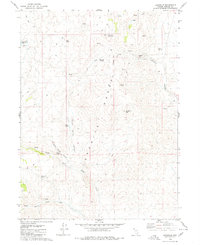
1980 Map of Leadville
USGS Topo · Published 1980About this map
Granite Range peaks dominate the topography of Washoe County in this 1980 survey, where the high-altitude Leadville (Site) marks the remains of a former mining settlement. Located on the eastern slopes of Leadville Mtn, the site is situated near a prospect and the Leadville Canyon drainage. The landscape is defined by its arid hydrology, featuring numerous named water sources like Chicken Spring and White Rock Spring that once supported local livestock and mining operations.
Find a feature on this map
27 named features on this map. Tap any name to fly to it.
Don’t see what you’re looking for? This feature index may not catch every label — zoom into the map to look around manually.
Map Details
Editions of this 1980 Leadville Map
This is the sole edition of this map. No revisions or reprints were ever made.
Other maps of this area

1886 · Granite Range
USGS Topo · 1:250,000

1889 · Long Valley
USGS Topo · 1:250,000

1894 · Granite Range
USGS Topo · 1:250,000

1954 · Vya
USGS Topo · 1:250,000

1955 · Lovelock
USGS Topo · 1:250,000

1958 · Vya
USGS Topo · 1:250,000

1959 · Lovelock
USGS Topo · 1:250,000

1962 · Vya
USGS Topo · 1:250,000

1979 · Butte Spring
USGS Topo · 1:24,000
1979 · Chester Lyons Spring
USGS Topo · 1:24,000