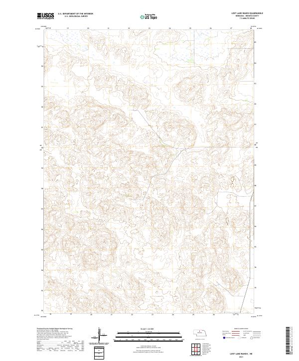
2021 Map of Lost Lake Ranch
USGS Topo · Published 2021About this map
Brown County's rolling sandhills terrain dominates this landscape, characterized by complex contour patterns and sparse surface water. The area is defined by the Public Land Survey System divisions of t29n r23w, t29n r22w, t28n r23w, and t28n r22w, which provide a formal grid over the otherwise fluid natural topography. Small, seasonal wetlands are scattered across the northern sections, suggesting the typical drainage patterns of the Nebraska sandhills region. This map serves primarily as a study of elevation and land division in a region where few permanent settlements or named landmarks were recorded at the time of the survey.
Find a feature on this map
4 named features on this map. Tap any name to fly to it.
Don’t see what you’re looking for? This feature index may not catch every label — zoom into the map to look around manually.
Map Details
Editions of this 2021 Lost Lake Ranch Map
This is the sole edition of this map. No revisions or reprints were ever made.
Other maps of this area

1950 · Wood Lake
USGS Topo · 1:62,500

1951 · Moon Lake
USGS Topo · 1:62,500

1954 · Ainsworth SW
USGS Topo · 1:24,000

1954 · Ainsworth
USGS Topo · 1:24,000

1955 · O'Neill
USGS Topo · 1:250,000

1957 · Valentine
USGS Topo · 1:250,000

1959 · Valentine
USGS Topo · 1:250,000

1959 · O'Neill
USGS Topo · 1:250,000

1969 · O'Neill
USGS Topo · 1:250,000

1982 · Lost Lake Ranch
USGS Topo · 1:24,000