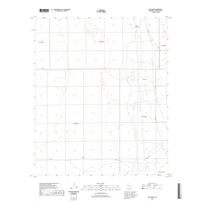
2020 Map of Lost River
USGS Topo · Published 2020About this map
Lost River winds through the southern reaches of this arid Otero County landscape, situated on the edge of the Poorman Range. The terrain is characterized by a sparse network of ephemeral drainages, including Sheep Camp Draw in the north and Hay Draw further south. This 2020 survey illustrates a modern desert geography defined by restricted access and utility routes rather than traditional settlements. The prominence of the Wsmr P Rt 10 and Wsmr P Rt 9 roads, alongside a rudimentary Jeep Trl, indicates the specialized use of this high-desert basin. The map provides a clear view of the public land survey system grid, showing the townships and ranges that organize this sparsely populated portion of New Mexico.
Find a feature on this map
12 named features on this map. Tap any name to fly to it.
Don’t see what you’re looking for? This feature index may not catch every label — zoom into the map to look around manually.
Map Details
Editions of this 2020 Lost River Map
This is the sole edition of this map. No revisions or reprints were ever made.
Other maps of this area

1916 · Tularosa
USGS Topo · 1:125,000

1916 · Point Of Sands
USGS Topo · 1:125,000

1947 · Point Of Sands 2
USGS Topo · 1:62,500

1948 · Lumley Lake
USGS Topo · 1:62,500

1948 · Tularosa
USGS Topo · 1:62,500

1948 · Holloman
USGS Topo · 1:62,500

1954 · Tularosa
USGS Topo · 1:250,000

1955 · Las Cruces
USGS Topo · 1:250,000

1958 · Las Cruces
USGS Topo · 1:250,000

1958 · Tularosa
USGS Topo · 1:250,000