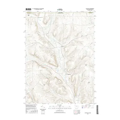
2016 Map of Lottsville
USGS Topo · Published 2016About this map
Little Brokenstraw Creek carves a central valley through this borderland where New York and Pennsylvania meet. The settlement of Lottsville serves as a focal point for the surrounding uplands, connected to Bear Lake in the northwest and Wrightsville to the south by a network of rural roads such as Lottsville Niobe Rd and Rte 6. The landscape is defined by its numerous rocky outcrops, including Pikes Rocks and Brooks Rocks, which stand as prominent landmarks above the drainage basins of Swamp Run and Blue Eye Run.
Find a feature on this map
54 named features on this map. Tap any name to fly to it.
Don’t see what you’re looking for? This feature index may not catch every label — zoom into the map to look around manually.
Map Details
Editions of this 2016 Lottsville Map
This is the sole edition of this map. No revisions or reprints were ever made.
Other maps of this area

1904 · Chautaqua
USGS Topo · 1:62,500

1905 · Clymer
USGS Topo · 1:62,500

1926 · Youngsville
USGS Topo · 1:62,500

1929 · Corry
USGS Topo · 1:48,000

1929 · Youngsville
USGS Topo · 1:62,500

1932 · Corry
USGS Topo · 1:62,500

1939 · Clymer
USGS Topo · 1:62,500

1941 · Chautauqua
USGS Topo · 1:62,500

1941 · Clymer
USGS Topo · 1:62,500

1943 · Youngsville
USGS Topo · 1:62,500