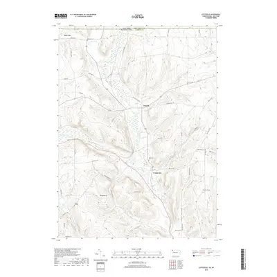
2019 Map of Lottsville
USGS Topo · Published 2019About this map
Little Brokenstraw Creek bisects this landscape as it flows through the valley between the rural settlements of Lottsville and Wrightsville. This 2019 survey documents the borderlands of the New York and Pennsylvania state line, where the southern reaches of Chautauqua County meet Warren County. The area is characterized by a high density of family and community landmarks, including several burial grounds such as Bear Lake Cem and Brooks Hill Cem. These sites, along with topographical features like Brooks Rocks and Danelson Hill, provide a stable reference for those tracing local history. The road network remains largely rural, with routes like Happy Town Rd and Lottsville Niobe Rd connecting small clusters of homes and farms that have defined this region for generations.
Find a feature on this map
53 named features on this map. Tap any name to fly to it.
Don’t see what you’re looking for? This feature index may not catch every label — zoom into the map to look around manually.
Map Details
Editions of this 2019 Lottsville Map
This is the sole edition of this map. No revisions or reprints were ever made.
Other maps of this area

1904 · Chautaqua
USGS Topo · 1:62,500

1905 · Clymer
USGS Topo · 1:62,500

1926 · Youngsville
USGS Topo · 1:62,500

1929 · Corry
USGS Topo · 1:48,000

1929 · Youngsville
USGS Topo · 1:62,500

1932 · Corry
USGS Topo · 1:62,500

1939 · Clymer
USGS Topo · 1:62,500

1941 · Chautauqua
USGS Topo · 1:62,500

1941 · Clymer
USGS Topo · 1:62,500

1943 · Youngsville
USGS Topo · 1:62,500