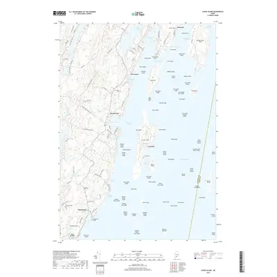
2018 Map of Louds Island
USGS Topo · Published 2018About this map
Louds Island and the surrounding waters of Muscongus Bay define this coastal landscape on the edge of Lincoln County. The map details a complex maritime environment where land and sea interlock through features like Muscongus Sound and Hockomock Channel. On the mainland, small settlements such as Round Pond and Chamberlain are connected by a network of local roads including Rock School House Rd and Old Co Rd, reflecting a landscape deeply tied to the Maine coast's traditional seafaring and residential patterns.
Find a feature on this map
136 named features on this map. Tap any name to fly to it.
Don’t see what you’re looking for? This feature index may not catch every label — zoom into the map to look around manually.
Map Details
Editions of this 2018 Louds Island Map
This is the sole edition of this map. No revisions or reprints were ever made.
Other maps of this area

1893 · Wiscasset
USGS Topo · 1:62,500

1893 · Boothbay
USGS Topo · 1:62,500

1904 · Monhegan
USGS Topo · 1:62,500

1906 · Monhegan
USGS Topo · 1:62,500

1913 · Waldoboro
USGS Topo · 1:48,000

1915 · Waldoboro
USGS Topo · 1:62,500

1941 · Waldoboro
USGS Topo · 1:62,500

1941 · Boothbay
USGS Topo · 1:62,500

1943 · Boothbay
USGS Topo · 1:62,500

1944 · Wiscasset
USGS Topo · 1:62,500