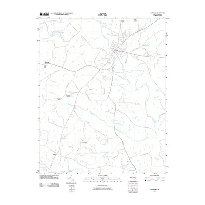
2010 Map of Louisburg
USGS Topo · Published 2010About this map
Louisburg sits at the heart of this Franklin County landscape, where the Tar River snakes through the center of the quadrangle. The town's historical expansion is evident in the layout of established landmarks like Oakwood Cemetery and the local aviation hubs at Franklin County Airport and Griffin Airport. The area is defined by a dense network of tributaries including Coole Creek, Wolfpen Branch, and Cedar Creek, which are punctuated by man-made water controls such as Timmerman Pond Dam and Cliftons Pond Dam.
Find a feature on this map
66 named features on this map. Tap any name to fly to it.
Don’t see what you’re looking for? This feature index may not catch every label — zoom into the map to look around manually.
Map Details
Editions of this 2010 Louisburg Map
This is the sole edition of this map. No revisions or reprints were ever made.
Other maps of this area

1902 · Spring Hope
USGS Topo · 1:62,500

1904 · Springhope
USGS Topo · 1:62,500

1953 · Raleigh
USGS Topo · 1:250,000

1953 · Greensboro
USGS Topo · 1:250,000

1954 · Greensboro
USGS Topo · 1:250,000

1954 · Raleigh
USGS Topo · 1:250,000

1962 · Greensboro
USGS Topo · 1:250,000

1966 · Greensboro
USGS Topo · 1:250,000
1967 · Rolesville
USGS Topo · 1:24,000

1968 · Bunn West
USGS Topo · 1:24,000