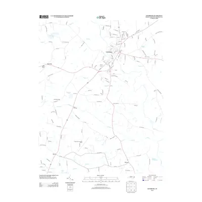
2013 Map of Louisburg
USGS Topo · Published 2013About this map
The Tar River bends through the heart of the landscape, anchoring the historic town of Louisburg. This 2013 survey documents the region's evolving infrastructure, featuring both the North Raleigh Airport near Katesville and the Triangle North Executive Airport further south. The geography is defined by a dense network of water bodies and family-named landmarks, such as Mitchiners Pond, Timmerman Pond, and Jacksons Pond. The rural character of Franklin County is evident in the scattered settlements of Royal and Raynor, connected by a series of named roads like May Rd and Peach Orchard Rd that trace older agricultural patterns. Significant crossings, such as the Timberlake Bridge over Cedar Cr, highlight the integration of modern transportation with the area's numerous tributaries, including Buffalo Cr and Big Br Cr.
Find a feature on this map
142 named features on this map. Tap any name to fly to it.
Don’t see what you’re looking for? This feature index may not catch every label — zoom into the map to look around manually.
Map Details
Editions of this 2013 Louisburg Map
This is the sole edition of this map. No revisions or reprints were ever made.
Other maps of this area

1902 · Spring Hope
USGS Topo · 1:62,500

1904 · Springhope
USGS Topo · 1:62,500

1953 · Raleigh
USGS Topo · 1:250,000

1953 · Greensboro
USGS Topo · 1:250,000

1954 · Greensboro
USGS Topo · 1:250,000

1954 · Raleigh
USGS Topo · 1:250,000

1962 · Greensboro
USGS Topo · 1:250,000

1966 · Greensboro
USGS Topo · 1:250,000
1967 · Rolesville
USGS Topo · 1:24,000

1968 · Bunn West
USGS Topo · 1:24,000