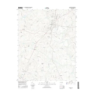
2016 Map of Louisburg
USGS Topo · Published 2016About this map
The Tar River snakes through this 2016 survey of Franklin County, framing the historic educational hub of Louisburg. At the heart of the settlement, Louisburg Coll and the nearby Oakwood Cem represent the community's deep-rooted institutional history. The landscape transitions from the developed streets of the county seat to rural outposts like Katesville, Royal, and Raynor, connected by a network of local roads such as W River Rd and Halifax Rd.
Find a feature on this map
124 named features on this map. Tap any name to fly to it.
Don’t see what you’re looking for? This feature index may not catch every label — zoom into the map to look around manually.
Map Details
Editions of this 2016 Louisburg Map
This is the sole edition of this map. No revisions or reprints were ever made.
Other maps of this area

1902 · Spring Hope
USGS Topo · 1:62,500

1904 · Springhope
USGS Topo · 1:62,500

1953 · Raleigh
USGS Topo · 1:250,000

1953 · Greensboro
USGS Topo · 1:250,000

1954 · Greensboro
USGS Topo · 1:250,000

1954 · Raleigh
USGS Topo · 1:250,000

1962 · Greensboro
USGS Topo · 1:250,000

1966 · Greensboro
USGS Topo · 1:250,000
1967 · Rolesville
USGS Topo · 1:24,000

1968 · Bunn West
USGS Topo · 1:24,000