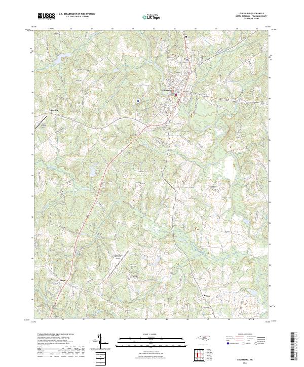
2022 Map of Louisburg
USGS Topo · Published 2022About this map
Louisburg serves as the focal point of this North Carolina landscape, where the Franklin County Courthouse and the campus of Louisburg College stand near the banks of the Tar River. The terrain is defined by a dense network of tributaries including Buffalo Cr, Cedar Cr, and Wolfpen Br, which drain the surrounding agricultural and timber lands. Smaller settlements such as Katesville to the west and Royal and Raynor to the south illustrate the persistent rural character of Franklin County, even as modern infrastructure like the Triangle North Executive Airport and North Raleigh Airport expand the area's footprint. Local genealogy researchers can find specific landmarks like Oakwood Cem and family-named water bodies such as Alford Brothers Pond and Jacksons Pond, which reflect generations of land ownership in the region.
Find a feature on this map
127 named features on this map. Tap any name to fly to it.
Don’t see what you’re looking for? This feature index may not catch every label — zoom into the map to look around manually.
Map Details
Editions of this 2022 Louisburg Map
This is the sole edition of this map. No revisions or reprints were ever made.
Other maps of this area

1902 · Spring Hope
USGS Topo · 1:62,500

1904 · Springhope
USGS Topo · 1:62,500

1953 · Raleigh
USGS Topo · 1:250,000

1953 · Greensboro
USGS Topo · 1:250,000

1954 · Greensboro
USGS Topo · 1:250,000

1954 · Raleigh
USGS Topo · 1:250,000

1962 · Greensboro
USGS Topo · 1:250,000

1966 · Greensboro
USGS Topo · 1:250,000
1967 · Rolesville
USGS Topo · 1:24,000

1968 · Bunn West
USGS Topo · 1:24,000