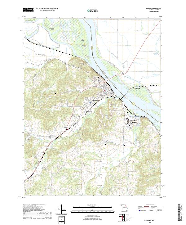
2021 Map of Louisiana
USGS Topo · Published 2021About this map
Louisiana sits at a critical bend of the Mississippi River, where the Champ Clark Bridge provides a vital link between Missouri and Illinois. This 2021 topographic perspective reveals a complex landscape shaped by both river commerce and the rolling hills of Pike County. The river corridor is defined by numerous landforms including Blackburn Island, Gosline Island, and Buffalo Island, while the western hills rise toward heights like Buffalo Knob and Davis Knob. The urban core of Louisiana is meticulously detailed with its street grid, featuring names like Nebraska St, Georgia St, and Washington St.
Find a feature on this map
101 named features on this map. Tap any name to fly to it.
Don’t see what you’re looking for? This feature index may not catch every label — zoom into the map to look around manually.
Map Details
Editions of this 2021 Louisiana Map
This is the sole edition of this map. No revisions or reprints were ever made.
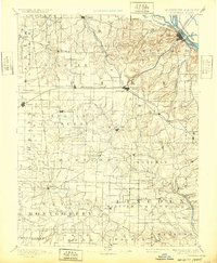
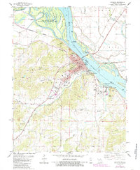
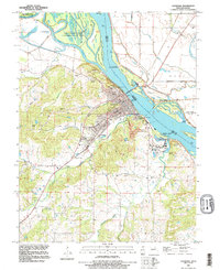
Historical Maps of Pike Through Time
4 maps found