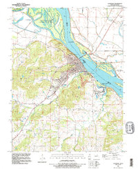
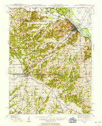
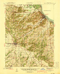
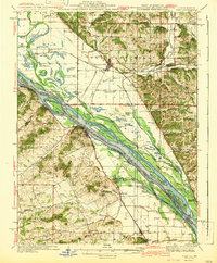
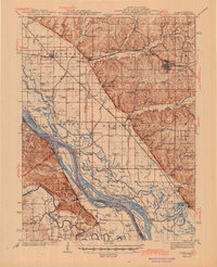
1991 Map of Louisiana
USGS Topo · Published 1995About this map
Louisiana sits at the heart of this riverfront landscape, where the Mississippi River meets a network of sloughs and islands. The city is a hub of local history, evidenced by its concentrated grid of streets and numerous cemeteries like Riverview Cem and Gates Of Peace Cem. The transport geography is defined by the Champ Clark Br crossing the river and the Illinois Missouri rail line, which served the river-and-rail economy near Quincy Junction. To the north and east, the map reveals a managed natural landscape including the Ted Shanks State Conservation Area and the Mark Twain National Wildlife Refuge. Numerous quarries and family-named landmarks like Buffalo Knob and Davis Knob suggest a landscape shaped by both industry and topography, while smaller settlements like Elmwood and Pike Station anchor the rural hinterland during the 1990s.
Find a feature on this map
50 named features on this map. Tap any name to fly to it.
Don’t see what you’re looking for? This feature index may not catch every label — zoom into the map to look around manually.
Map Details
Editions of this 1991 Louisiana Map
This is the sole edition of this map. No revisions or reprints were ever made.
Other maps of this area

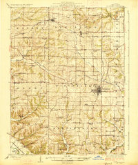
1890 · Louisiana
USGS Topo · 1:125,000
1926 · Pittsfield
USGS Topo · 1:62,500

1930 · Nebo
USGS Topo · 1:62,500

1931 · Barry
USGS Topo · 1:62,500
1934 · Nebo
USGS Topo · 1:48,000
1936 · Barry
USGS Topo · 1:48,000
1937 · Bowling Green
USGS Topo · 1:62,500
1940 · Bowling Green
USGS Topo · 1:62,500
1942 · Nebo
USGS Topo · 1:62,500
1944 · Barry
USGS Topo · 1:62,500