
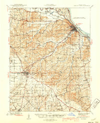
1940 Map of Bowling Green
USGS Topo · Published 1940About this map
Bowling Green serves as a central hub on this 1937 survey, where the St Louis and Hannibal and Chicago and Alton railroads intersect. To the northeast, the city of Louisiana sits along the Mississippi River, connected to Illinois via the Champ Clark Bridge. The landscape is defined by the convergence of the Salt River and its numerous tributaries, including Noix Creek and Buffalo Creek, which carve through the townships of Cuivre, Buffalo, and Calumet.
Find a feature on this map
80 named features on this map. Tap any name to fly to it.
Don’t see what you’re looking for? This feature index may not catch every label — zoom into the map to look around manually.
Map Details
Editions of this 1940 Bowling Green Map
2 editions found
Other maps of this area

1890 · Louisiana
USGS Topo · 1:125,000

1926 · Pittsfield
USGS Topo · 1:62,500

1930 · Nebo
USGS Topo · 1:62,500

1931 · Barry
USGS Topo · 1:62,500

1932 · Hannibal
USGS Topo · 1:62,500

1934 · Nebo
USGS Topo · 1:48,000

1934 · Elsberry
USGS Topo · 1:48,000

1936 · Hannibal
USGS Topo · 1:48,000

1936 · Barry
USGS Topo · 1:48,000

1937 · Silex
USGS Topo · 1:62,500