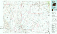
1984 Map of Louse Canyon
USGS Topo · Published 1986About this map
The Fort Mcdermitt Indian Reservation straddles the border of Oregon and Nevada in this high-desert region, where the town of McDermitt serves as a primary hub for travel along Highway 95. The landscape is dominated by the intricate drainage systems of the Owyhee River and the Little Owyhee River, which have carved deep canyons like Louse Canyon Creek through the volcanic plateaus. To the west, the Oregon Canyon Mountains and the heights of Blue Mountain provide a dramatic backdrop to the vast flats and rangelands.
Find a feature on this map
128 named features on this map. Tap any name to fly to it.
Don’t see what you’re looking for? This feature index may not catch every label — zoom into the map to look around manually.
Map Details
Editions of this 1984 Louse Canyon Map
This is the sole edition of this map. No revisions or reprints were ever made.
Other maps of this area

1882 · Paradise
USGS Topo · 1:250,000

1886 · Disaster
USGS Topo · 1:250,000

1893 · Paradise
USGS Topo · 1:250,000

1893 · Disaster
USGS Topo · 1:250,000

1954 · Vya
USGS Topo · 1:250,000

1955 · McDermitt
USGS Topo · 1:250,000

1955 · Jordan Valley
USGS Topo · 1:250,000

1955 · Adel
USGS Topo · 1:250,000

1957 · Adel
USGS Topo · 1:250,000

1957 · Jordan Valley
USGS Topo · 1:250,000