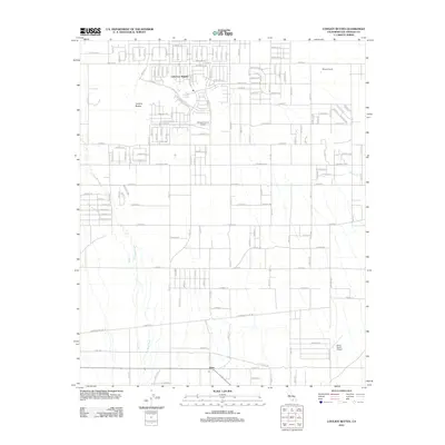
2012 Map of Lovejoy Buttes
USGS Topo · Published 2012About this map
Lake Los Angeles and the surrounding high desert of the Antelope Valley define this 2012 survey, revealing a landscape of grid-patterned residential streets juxtaposed against expansive alluvial washes. To the south, the settlement of Llano sits along the foothills, while the prominent rock formations of Lovejoy Buttes and the nearby Lovejoy Springs serve as central landmarks in this arid environment. The map details a transition from dense suburban plotting near Lake Los Angeles to the more dispersed agricultural and ranching tracts of Wilsona Ranch. Transportation is characterized by the alphanumeric road system, including E Avenue P and E Palmdale Blvd, while the aviation history of the region is marked by the Nichols Farms Airport and Brian Ranch Airport. Water drainage patterns are clearly visible through the branching paths of Big Rock Wash, Rock Creek, and Mescal Cr, illustrating the natural hydrology that flows toward the valley floor.
Find a feature on this map
62 named features on this map. Tap any name to fly to it.
Don’t see what you’re looking for? This feature index may not catch every label — zoom into the map to look around manually.
Map Details
Editions of this 2012 Lovejoy Buttes Map
This is the sole edition of this map. No revisions or reprints were ever made.
Other maps of this area

1901 · Southern California Sheet No. 1
USGS Topo · 1:250,000

1903 · Rock Creek
USGS Topo · 1:62,500

1903 · San Antonio
USGS Topo · 1:62,500

1904 · Southern California Sheet No. 1
USGS Topo · 1:250,000

1930 · Lovejoy Springs
USGS Topo · 1:24,000

1930 · Black Butte
USGS Topo · 1:24,000

1930 · Llano
USGS Topo · 1:24,000

1930 · Wilsona
USGS Topo · 1:24,000

1933 · Lovejoy Springs
USGS Topo · 1:24,000

1933 · Black Butte
USGS Topo · 1:24,000