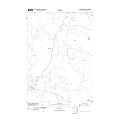
2012 Map of Lovering Mountain
USGS Topo · Published 2012About this map
The Mohawk River flows through the southern portion of this landscape, anchoring the town of Colebrook in Coos County. This northern New Hampshire terrain is defined by a series of prominent peaks and water bodies, including Lovering Mountain, Mudget Mountain, and the waters of Matthews Pond and Lombard Pond. The settlement pattern follows the brook valleys and ridge lines, connecting Stewartstown Hollow to the outlying hills.
Find a feature on this map
99 named features on this map. Tap any name to fly to it.
Don’t see what you’re looking for? This feature index may not catch every label — zoom into the map to look around manually.
Map Details
Editions of this 2012 Lovering Mountain Map
This is the sole edition of this map. No revisions or reprints were ever made.
Other maps of this area

1925 · Indian Stream
USGS Topo · 1:48,000

1926 · Indian Stream
USGS Topo · 1:62,500

1927 · Indian Stream
USGS Topo · 1:62,500

1929 · Averill
USGS Topo · 1:62,500

1930 · Dixville
USGS Topo · 1:62,500

1933 · Dixville
USGS Topo · 1:62,500

1934 · Dixville
USGS Topo · 1:62,500

1949 · Jackman
USGS Topo · 1:250,000

1950 · Lewiston
USGS Topo · 1:250,000

1953 · Averill
USGS Topo · 1:62,500