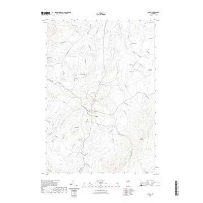
2021 Map of Lowell
USGS Topo · Published 2021About this map
Lowell sits at a crossroads in the northern Vermont landscape, where the Missisquoi River and the E Br Missisquoi River meet beneath the high peaks of the Green Mountains and the Lowell Mountains. This 2021 survey illustrates a community defined by its topography, with numerous family-named roads like Potter Rd, Guyette Rd, and Cheney Rd reaching into the foothills. The area's local history is anchored by several burial grounds, including Saint Ignatius Cem, Old Catholic Cem, and Mountainview Cem clustered near the village center. To the west, the winding Hazens Notch Rd climbs toward the heights of Strawberry Hill and Browns Ledges, while the eastern portion of the quadrangle is marked by high-elevation water features such as McAllister Pond and the headwaters of Mineral Spring Brook.
Find a feature on this map
74 named features on this map. Tap any name to fly to it.
Don’t see what you’re looking for? This feature index may not catch every label — zoom into the map to look around manually.
Map Details
Editions of this 2021 Lowell Map
This is the sole edition of this map. No revisions or reprints were ever made.
Other maps of this area

1919 · Montgomery
USGS Topo · 1:62,500

1920 · Montgomery
USGS Topo · 1:62,500

1920 · Irasburg
USGS Topo · 1:62,500

1923 · Irasburg
USGS Topo · 1:48,000

1925 · Irasburg
USGS Topo · 1:62,500

1925 · Jay Peak
USGS Topo · 1:62,500

1927 · Hyde Park
USGS Topo · 1:48,000

1928 · Hardwick
USGS Topo · 1:62,500

1930 · Hyde Park
USGS Topo · 1:62,500

1934 · Hardwick
USGS Topo · 1:48,000