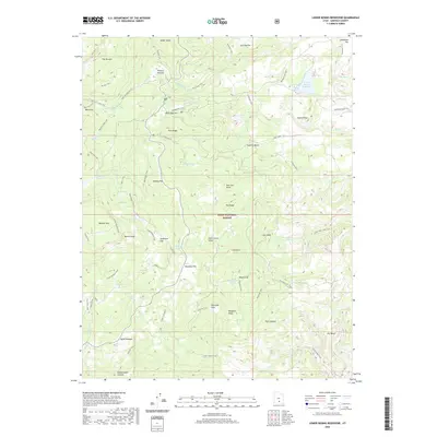
2020 Map of Lower Bowns Reservoir
USGS Topo · Published 2020About this map
Dixie National Forest covers this high-altitude landscape in Garfield County, characterized by a complex network of trails and water management features. Lower Bowns Reservoir and the Oak Cr Reservoir serve as primary water bodies, while smaller alpine features like Steep Cr Lake, Round Lake, and Scout Lake dot the terrain. The presence of named grazing areas such as Wildcat Pasture, Parks Pasture, and Bear Flat suggests a legacy of high-country ranching.
Find a feature on this map
67 named features on this map. Tap any name to fly to it.
Don’t see what you’re looking for? This feature index may not catch every label — zoom into the map to look around manually.
Map Details
Editions of this 2020 Lower Bowns Reservoir Map
This is the sole edition of this map. No revisions or reprints were ever made.
Other maps of this area

1885 · Fish Lake
USGS Topo · 1:250,000

1886 · Escalante
USGS Topo · 1:250,000

1896 · Fish Lake
USGS Topo · 1:250,000

1952 · Notom 3 SW
USGS Topo · 1:24,000

1952 · Notom 3 NW
USGS Topo · 1:24,000

1952 · Notom 4 NW
USGS Topo · 1:24,000

1952 · Notom 4 SW
USGS Topo · 1:24,000

1952 · Notom 3 SE
USGS Topo · 1:24,000

1952 · Notom 3 NE
USGS Topo · 1:24,000

1952 · Grover
USGS Topo · 1:62,500