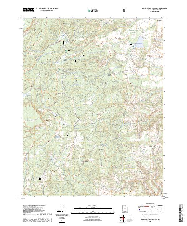
2023 Map of Lower Bowns Reservoir
USGS Topo · Published 2023About this map
Dixie National Forest dominates this high-altitude landscape in Garfield County, where a network of reservoirs and natural lakes supports the region's hydrology. The map centers on Lower Bowns Reservoir and its namesake Bowns Lakes, connected by a complex system of water bodies including Scout Lake, Long Lake, and Oak Cr Reservoir. The terrain transitions from the broad expanse of Boulder Mtn and The Terrace down to distinct local landmarks like Point Lookout and the steep incisions of Cottonwood Canyon. Transport across this remote backcountry is defined by a dense web of established routes such as the Great Western Trl, Bowns Stock Drive Trl, and Slickrock Trl, illustrating the area's continued reliance on seasonal access for grazing and recreation. Pastoral areas like Parks Pasture and Wildcat Pasture sit tucked between ridges, reflecting the long-standing land use patterns of the Utah plateaus.
Find a feature on this map
72 named features on this map. Tap any name to fly to it.
Don’t see what you’re looking for? This feature index may not catch every label — zoom into the map to look around manually.
Map Details
Editions of this 2023 Lower Bowns Reservoir Map
This is the sole edition of this map. No revisions or reprints were ever made.
Other maps of this area

1885 · Fish Lake
USGS Topo · 1:250,000

1886 · Escalante
USGS Topo · 1:250,000

1896 · Fish Lake
USGS Topo · 1:250,000

1952 · Notom 3 SW
USGS Topo · 1:24,000

1952 · Notom 3 NW
USGS Topo · 1:24,000

1952 · Notom 4 NW
USGS Topo · 1:24,000

1952 · Notom 4 SW
USGS Topo · 1:24,000

1952 · Notom 3 SE
USGS Topo · 1:24,000

1952 · Notom 3 NE
USGS Topo · 1:24,000

1952 · Grover
USGS Topo · 1:62,500