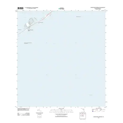
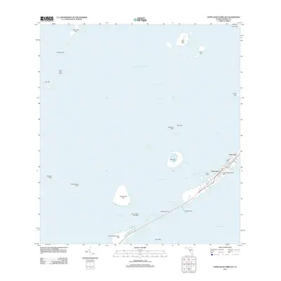
2012 Map of Lower Matecumbe Key
USGS Topo · Published 2012About this map
Lower Matecumbe Key and the surrounding waters of Monroe County are defined here by a narrow corridor of development situated between the Gulf of Mexico and the Atlantic Ocean. The residential streets of Lower Matecumbe Beach, such as El Capitan Dr and Biscayne Blvd, are clustered along the northwestern edge of the key, facing the shallow reaches of Florida Bay. This 2012 survey illustrates the modern transportation footprint of Old US Hwy 1 as it transitions across the islands toward Channel Two. Submerged features are just as significant as the landmass here, with the South Islamorada Underwater Coral Gardens noted in the Hawk Channel. Other maritime markers like Indian Key Anchorage and Matecumbe Harbor indicate the area's deep-rooted connection to coastal navigation and the seafaring economy of the Florida Keys.
Find a feature on this map
26 named features on this map. Tap any name to fly to it.
Don’t see what you’re looking for? This feature index may not catch every label — zoom into the map to look around manually.
Map Details
Editions of this 2012 Lower Matecumbe Key Map
This is the sole edition of this map. No revisions or reprints were ever made.
Other maps of this area

1971 · Upper Matecumbe Key
USGS Topo · 1:24,000

1971 · Plantation Key
USGS Topo · 1:24,000

1971 · Long Key
USGS Topo · 1:24,000
1971 · Lower Matecumbe Key
USGS Topo · 1:24,000

1972 · Buchanan Keys
USGS Topo · 1:24,000

1983 · Islamorada
USGS Topo · 1:100,000

1989 · Key West
USGS Topo · 1:250,000
2012 · Buchanan Keys
USGS Topo · 1:24,000
2012 · Plantation Key
USGS Topo · 1:24,000
2012 · Upper Matecumbe Key
USGS Topo · 1:24,000