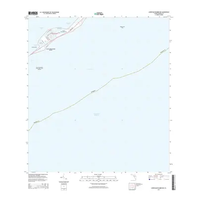
2015 Map of Lower Matecumbe Key
USGS Topo · Published 2015About this map
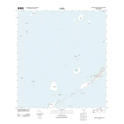
Lower Matecumbe Key and its surrounding waters are defined by the narrow ribbon of land and sea that makes up this section of the Florida Keys. The primary settlement at Lower Matecumbe Beach is organized around a network of residential streets such as Ponce De Leon Blvd, Costa Bravo Dr, and Sunset Dr, all oriented toward the waterfront. The Overseas Hwy serves as the central spine for transportation, connecting the small harbor areas like Matecumbe Harbor to the larger keys. To the south, the South Islamorada Underwater Coral Gardens indicate the preservation of the marine environment within the Atlantic Ocean. The geography highlights the delicate balance between land and water, with Florida Bay to the north and the deep Hawk Channel to the south, separated by small outcroppings like Veterans Key.
Find a feature on this map
24 named features on this map. Tap any name to fly to it.
Don’t see what you’re looking for? This feature index may not catch every label — zoom into the map to look around manually.
Map Details
Editions of this 2015 Lower Matecumbe Key Map
This is the sole edition of this map. No revisions or reprints were ever made.
Other maps of this area

1971 · Upper Matecumbe Key
USGS Topo · 1:24,000

1971 · Plantation Key
USGS Topo · 1:24,000

1971 · Long Key
USGS Topo · 1:24,000
1971 · Lower Matecumbe Key
USGS Topo · 1:24,000

1972 · Buchanan Keys
USGS Topo · 1:24,000

1983 · Islamorada
USGS Topo · 1:100,000

1989 · Key West
USGS Topo · 1:250,000
2012 · Buchanan Keys
USGS Topo · 1:24,000
2012 · Plantation Key
USGS Topo · 1:24,000
2012 · Upper Matecumbe Key
USGS Topo · 1:24,000