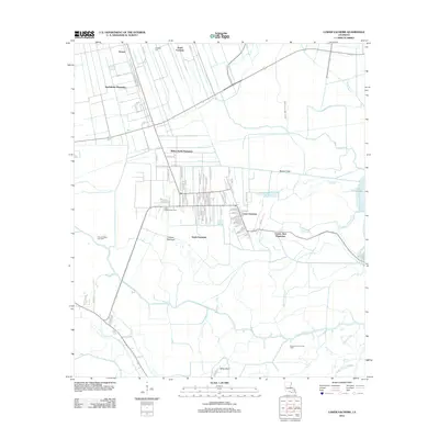
2012 Map of Lower Vacherie
USGS Topo · Published 2012About this map
North Vacherie and its surrounding agricultural corridor define this landscape in the Mississippi River delta region of St. James Parish. The map reveals a distinct settlement pattern where traditional landholdings like Southdown Plantation, Webre Steib Plantation, and Golden Star Plantation sit amidst a complex network of waterways and drainage canals. These plantations, along with communities such as Lower Vacherie and South Vacherie, are situated on the higher ground of the natural levee, transitioning into the sprawling wetlands of the south. Beyond the residential and agricultural zones, the geography is dominated by a labyrinth of bayous, including the prominent Bayou Chevreuil and Bayou Piquant, which flow toward the expansive Lac des Allemands. The integration of energy infrastructure is evident through the Citamon Bayou Gas Field and Lower Vacherie Gas Field, highlighting the region's industrial ties to the Louisiana marshland.
Find a feature on this map
87 named features on this map. Tap any name to fly to it.
Don’t see what you’re looking for? This feature index may not catch every label — zoom into the map to look around manually.
Map Details
Editions of this 2012 Lower Vacherie Map
This is the sole edition of this map. No revisions or reprints were ever made.
Other maps of this area

1892 · Lac Des Allemands
USGS Topo · 1:62,500

1892 · Mount Airy
USGS Topo · 1:62,500

1892 · Donaldsonville
USGS Topo · 1:62,500

1892 · Thibodaux
USGS Topo · 1:62,500

1932 · Lac Des Allemands NW
USGS Topo · 1:31,680

1932 · Lac Des Allemands SE
USGS Topo · 1:31,680

1932 · Lac Des Allemands SW
USGS Topo · 1:31,680

1932 · Thibodaux NE
USGS Topo · 1:31,680

1932 · Lac Des Allemands NE
USGS Topo · 1:31,680

1932 · Thibodaux SE
USGS Topo · 1:31,680
Featured Places
- North Vacherie, LA
- Southdown Plantation, LA
- South Vacherie, LA
- Webre Steib Plantation, LA
- Golden Star Plantation, LA