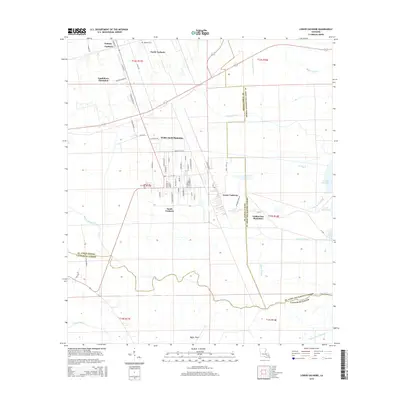
2015 Map of Lower Vacherie
USGS Topo · Published 2015About this map
Golden Star Plantation and Webre Steib Plantation dominate this 2015 study of the St. James Parish landscape, where the long-lot land divisions characteristic of French colonial influence meet the expansive wetlands of the Mississippi River delta. The settlement pattern follows the higher ground along Vacherie and North Vacherie, giving way to a complex network of waterways including Bayou Becnel and the Vacherie Canal. This modern survey illustrates how traditional plantation boundaries and residential roads like Judge Becnel Ln and Dicks Farm Rd continue to organize the region. To the south and east, the map captures the transition into the swampy margins of Lac des Allemands, defined by features such as Coulee du Cimetiere and Ti Bayou, which illustrate the persistent role of natural drainage in shaping Louisiana's rural infrastructure.
Find a feature on this map
66 named features on this map. Tap any name to fly to it.
Don’t see what you’re looking for? This feature index may not catch every label — zoom into the map to look around manually.
Map Details
Editions of this 2015 Lower Vacherie Map
This is the sole edition of this map. No revisions or reprints were ever made.
Other maps of this area

1892 · Lac Des Allemands
USGS Topo · 1:62,500

1892 · Mount Airy
USGS Topo · 1:62,500

1892 · Donaldsonville
USGS Topo · 1:62,500

1892 · Thibodaux
USGS Topo · 1:62,500

1932 · Lac Des Allemands NW
USGS Topo · 1:31,680

1932 · Lac Des Allemands SE
USGS Topo · 1:31,680

1932 · Lac Des Allemands SW
USGS Topo · 1:31,680

1932 · Thibodaux NE
USGS Topo · 1:31,680

1932 · Lac Des Allemands NE
USGS Topo · 1:31,680

1932 · Thibodaux SE
USGS Topo · 1:31,680
Featured Places
- North Vacherie, LA
- Southdown Plantation, LA
- South Vacherie, LA
- Webre Steib Plantation, LA
- Golden Star Plantation, LA