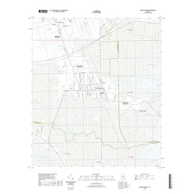
2020 Map of Lower Vacherie
USGS Topo · Published 2020About this map
Southdown Plantation and Webre Steib Plantation anchor the landscape of this St. James Parish region, where the traditional agricultural footprint of the Mississippi River's west bank transitions into the extensive wetlands of the Acadian Coast. The settlement pattern follows a distinct linear arrangement along local thoroughfares like La 20, concentrating residents in centers such as South Vacherie and Lower Vacherie. This document records the intricate network of watercourses that define the local drainage, including Bayou Chevreuil and the Vacherie Canal, which navigate the low-lying terrain toward Pleasure Bend. Cultural landmarks such as Highway Baptist Church and Our Lady of Peace Cem provide specific points of interest for genealogists tracing family roots in this historically French-influenced corridor. The map effectively captures the intersection of residential expansion and the persistent bayou systems that shape the southern Louisiana parishes.
Find a feature on this map
71 named features on this map. Tap any name to fly to it.
Don’t see what you’re looking for? This feature index may not catch every label — zoom into the map to look around manually.
Map Details
Editions of this 2020 Lower Vacherie Map
This is the sole edition of this map. No revisions or reprints were ever made.
Other maps of this area

1892 · Lac Des Allemands
USGS Topo · 1:62,500

1892 · Mount Airy
USGS Topo · 1:62,500

1892 · Donaldsonville
USGS Topo · 1:62,500

1892 · Thibodaux
USGS Topo · 1:62,500

1932 · Lac Des Allemands NW
USGS Topo · 1:31,680

1932 · Lac Des Allemands SE
USGS Topo · 1:31,680

1932 · Lac Des Allemands SW
USGS Topo · 1:31,680

1932 · Thibodaux NE
USGS Topo · 1:31,680

1932 · Lac Des Allemands NE
USGS Topo · 1:31,680

1932 · Thibodaux SE
USGS Topo · 1:31,680
Featured Places
- North Vacherie, LA
- Southdown Plantation, LA
- South Vacherie, LA
- Webre Steib Plantation, LA
- Golden Star Plantation, LA