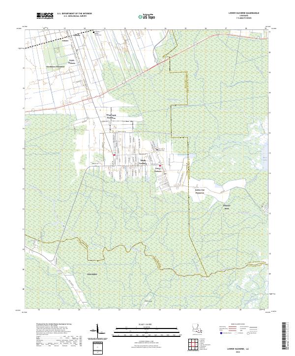
2024 Map of Lower Vacherie
USGS Topo · Published 2024About this map
Southdown Plantation and Webre Steib Plantation occupy the elevated grounds of the West Bank in this survey of St. James Parish. The landscape transitions sharply from the established settlements of North Vacherie and Lower Vacherie into a dense network of wetlands defined by the Bayou Chevreuil and Bayou Lassene systems. These waterways and canals, such as the Vacherie Canal, illustrate the historic drainage patterns essential to the region's agricultural economy. Further south, the map details the transition into the swampy reaches of Chackbay, where the land fragments into points like Miller Point and water bodies including Grand Bayou. The layout of local roads, such as Judge Becnel Ln and Webre Steib Rd, follows the traditional long-lot survey patterns characteristic of Louisiana's river parishes, providing a look at the enduring spatial organization of these historic communities.
Find a feature on this map
81 named features on this map. Tap any name to fly to it.
Don’t see what you’re looking for? This feature index may not catch every label — zoom into the map to look around manually.
Map Details
Editions of this 2024 Lower Vacherie Map
This is the sole edition of this map. No revisions or reprints were ever made.
Other maps of this area

1892 · Lac Des Allemands
USGS Topo · 1:62,500

1892 · Mount Airy
USGS Topo · 1:62,500

1892 · Donaldsonville
USGS Topo · 1:62,500

1892 · Thibodaux
USGS Topo · 1:62,500

1932 · Lac Des Allemands NW
USGS Topo · 1:31,680

1932 · Lac Des Allemands SE
USGS Topo · 1:31,680

1932 · Lac Des Allemands SW
USGS Topo · 1:31,680

1932 · Thibodaux NE
USGS Topo · 1:31,680

1932 · Lac Des Allemands NE
USGS Topo · 1:31,680

1932 · Thibodaux SE
USGS Topo · 1:31,680