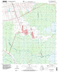
1998 Map of Lower Vacherie
USGS Topo · Published 2000About this map
Lower Vacherie and its surrounding sugar country are the focus of this landscape, where the long-lot ribbon farm patterns of the Mississippi River backlands meet the sprawling wetlands of the upper Barataria Basin. The map records the cultural footprint of the late 20th century atop a much older agricultural foundation, clearly delineating the Webre Steib Plantation, Southdown Plantation, and Golden Star Plantation. These holdings transition from cultivated fields into the intricate hydrology of the swamps, defined by Bayou Chevreuil and the Dredge Boat Canal.
Find a feature on this map
33 named features on this map. Tap any name to fly to it.
Don’t see what you’re looking for? This feature index may not catch every label — zoom into the map to look around manually.
Map Details
Editions of this 1998 Lower Vacherie Map
This is the sole edition of this map. No revisions or reprints were ever made.
Other maps of this area

1892 · Lac Des Allemands
USGS Topo · 1:62,500

1892 · Mount Airy
USGS Topo · 1:62,500

1892 · Donaldsonville
USGS Topo · 1:62,500

1892 · Thibodaux
USGS Topo · 1:62,500

1932 · Lac Des Allemands NW
USGS Topo · 1:31,680

1932 · Lac Des Allemands SE
USGS Topo · 1:31,680

1932 · Lac Des Allemands SW
USGS Topo · 1:31,680

1932 · Thibodaux NE
USGS Topo · 1:31,680

1932 · Lac Des Allemands NE
USGS Topo · 1:31,680

1932 · Thibodaux SE
USGS Topo · 1:31,680
Featured Places
- Golden Star Plantation, LA
- North Vacherie, LA
- Southdown Plantation, LA
- Armant, LA
- Webre Steib Plantation, LA