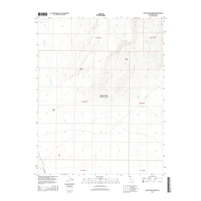
2015 Map of Lower Warm Springs
USGS Topo · Published 2015About this map
Death Valley National Park encompasses the rugged landscape of this quadrangle, where the arid reaches of the Mojave Desert meet the sharp elevation changes of the Saline Range. This 2015 survey details the isolated water sources essential to the region's geography, notably Lower Warm Springs and Palm Spring, which emerge along the eastern margins of the mountains. To the southwest, the topography flattens into the Saline Valley, a desert basin defined by The Dunes and the seasonal drainage patterns of Waucoba Wash. The presence of Saline Valley Rd provides the primary corridor through this remote terrain, following the valley floor. The map’s township and range grids, such as t13s r38e, illustrate the late-twentieth and early-twenty-first-century administrative land management within one of the most extreme environments in the American West.
Find a feature on this map
15 named features on this map. Tap any name to fly to it.
Don’t see what you’re looking for? This feature index may not catch every label — zoom into the map to look around manually.
Map Details
Editions of this 2015 Lower Warm Springs Map
This is the sole edition of this map. No revisions or reprints were ever made.
Other maps of this area

1908 · Ballarat
USGS Topo · 1:250,000

1913 · Ballarat
USGS Topo · 1:250,000

1948 · Death Valley
USGS Topo · 1:250,000

1950 · New York Butte
USGS Topo · 1:62,500

1950 · Ubehebe Peak
USGS Topo · 1:62,500

1951 · New York Butte
USGS Topo · 1:62,500

1951 · Ubehebe Peak
USGS Topo · 1:62,500

1951 · Waucoba Wash
USGS Topo · 1:62,500

1954 · Death Valley
USGS Topo · 1:250,000

1956 · Death Valley
USGS Topo · 1:250,000